Source: National Weather Service
"A strong Pacific storm system will bring impactful and dangerous flooding rains, heavy snow, strong winds, coastal flooding, and high surf to California. Heavy rainfall will bring the threat for life-threatening flash, urban, and river flooding as well as debris flows and mudslides. High elevation snow may produce whiteout conditions and dangerous, near impossible travel conditions"
The source of the above is the NWS
Citizens Press Release
November 15, 2022 - Tallahassee
Citizens Property Insurance Corporation has updated its Hurricane Ian estimates to reflect additional costs expected from litigation and other claims-related expenses.
Citizens estimates that direct losses and loss adjustment expenses will total $3.8 billion from the Category 4 storm that slammed into Southwest Florida on September 28, 2022. This represents a significant increase over the preliminary estimate of $2.3 billion to $2.6 billion, which was based strictly on the results of a single hurricane model.
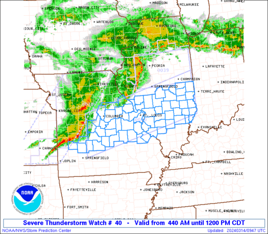
Source: NOAA's Storm Prediction Center
Preliminary Reports
Updated 12/13
Tornado Reports -64
Hail Reports - 24
Wind Reports - 370
NOAA received a total of 557 Reports
based on report data at 8 AM
28 Tornado Reports
388 Wind Reports
141 Hail Reports
Source: NOAA
"The so-called bomb cyclone that brought heavy snow, blizzard conditions and major flooding to the Midwest in March landed with a resounding meteorological “ka-boom!” and became one of two billion-dollar weather and climate disasters this year.
The other was a severe storm that struck the Northeast, Southeast and Ohio Valley in late February."
The above is from the NOAA article, follow the Read More link for the article.
Source: NOAA
From the NOAA Report;
"Nearly two-thirds of the Lower 48 states face an elevated risk for flooding through May, with the potential for major or moderate flooding in 25 states, according to NOAA’s U.S. Spring Outlook issued today. The majority of the country is favored to experience above-average precipitation this spring, increasing the flood risk.
Portions of the United States – especially in the upper Mississippi and Missouri River basins including Nebraska, Minnesota and Iowa – have already experienced record flooding this year. This early flooding was caused by rapid snow melt combined with heavy spring rain and late season snowfall in areas where soil moisture is high. In some areas, ice jams are exacerbating the flooding. Offices across the National Weather Service have been working with local communities, providing decision-support services and special briefings to emergency managers and other leaders in local, state and federal government to ensure the highest level of readiness before the flooding began."
Santa Cruz County Prepares For Worst As Big Storm Approaches CBS San FranciscoWith the next storm bearing down on the Northern California, crews are racing to shore up the hillsides in the Santa Cruz mountains.
Winter Storm Damage Keeping Tree Service Crews Busy CBS PittsburghDowned branches and trees caused by Thursday night's winter storms kept tree *service* crews busy throughout the area Friday.
Ice storm damage, Mercer County WVVA TVMany residents and commuters felt the impact of Thursday's ice storm. Drivers across the State were warned to watch out for the ice on all roads. But.
Election day storm damage in Knoxville Knoxville News SentinelThe early morning storm Nov. 6 left at least two roads blocked by toppled trees in North Hills. This dead tree fell across Haggard Road and tore down wires, ...
Storm damage in the Tennessee Valley WAFFTwo tornadoes touched down in Lauderdale and Jackson Counties.
VID | Major storm damage in Mt. Airy; town reports tornado Fox BaltimoreMT. AIRY, Md. (WBFF) - Multiple businesses were seen damaged in Mt. Airy as severe storms came through Friday evening. The Town of Mount Airy said on ...
Source: Colorado Springs Gazette
USAA received 8,000 claims for damage to homes and vehicles Tuesday, twice as many as from the June 13 hailstorm that hit Fountain, the insurance and financial services giant reported. Other top insurers, including State Farm, Farmers and Progressive, didn’t have claims numbers or didn’t return calls.
WW 40 TORNADO AR LA OK TX 131850Z - 140300Z
URGENT - IMMEDIATE BROADCAST REQUESTED
Tornado Watch Number 40
NWS Storm Prediction Center Norman OK
150 PM CDT Fri Apr 13 2018

The NWS Storm Prediction Center has issued a

* Tornado Watch for portions of
  Much of Arkansas
  Northwest Louisiana
  Southeast Oklahoma
  Northeast Texas

* Effective this Friday afternoon and evening from 150 PM until
  1000 PM CDT.

...THIS IS A PARTICULARLY DANGEROUS SITUATION...

* Primary threats include...
  Numerous tornadoes expected with a few intense tornadoes likely
  Widespread large hail and isolated very large hail events to 2.5
    inches in diameter likely
  Widespread damaging wind gusts to 70 mph likely

SUMMARY...Intense thunderstorms are expected to track across the
watch area this afternoon and early evening, posing a risk of
tornadoes, large hail and damaging winds.  Strong tornadoes are
possible.  Multiple rounds of severe storms are expected across this
region.

The tornado watch area is approximately along and 70 statute miles
east and west of a line from 70 miles south of Longview TX to 20
miles northeast of Flippin AR. For a complete depiction of the watch
see the associated watch outline update (WOUS64 KWNS WOU0).

PRECAUTIONARY/PREPAREDNESS ACTIONS...

REMEMBER...A Tornado Watch means conditions are favorable for
tornadoes and severe thunderstorms in and close to the watch
area. Persons in these areas should be on the lookout for
threatening weather conditions and listen for later statements
and possible warnings.

&&

OTHER WATCH INFORMATION...CONTINUE...WW 39...

AVIATION...Tornadoes and a few severe thunderstorms with hail
surface and aloft to 2.5 inches. Extreme turbulence and surface wind
gusts to 60 knots. A few cumulonimbi with maximum tops to 500. Mean
storm motion vector 24035.

...Hart
Read more
16 billion-dollar weather and climate disasters made for costliest year on record
January 8, 2018 2017 will be remembered as a year of extremes for the U.S. as floods, tornadoes, hurricanes, drought, fires and freezes claimed hundreds of lives and visited economic hardship upon the nation. Recovery from the ravages of three major Atlantic hurricanes making landfall in the U.S. and an extreme and ongoing wildfire season in the West is expected to continue well into the new year.